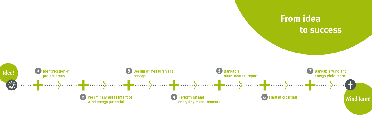
Identification of project areas
GEO-NET will support you professionally by identifying suitable sites for your wind energy project.
Within the scope of a wind potential study, the wind field is simulated for the searching area with our mesoscale air flow model FITNAH-3D. Applying geographic information system (GIS) programs, we will consider nature conservation and planning requirements. These include restrictions such as distance from inhabited areas, flight security and requirements related to the protection of species or location characteristics such as infrastructure, distance to the grid connection point and terrain conditions.
According to the criteria specified by you (such as minimum wind speed at hub height, minimum height of the planned wind generators, minimum size of area), we will identify the most suitable areas in which your wind energy plants can produce “green” electricity. For further planning and realisation steps, all information will be provided in a GIS project.